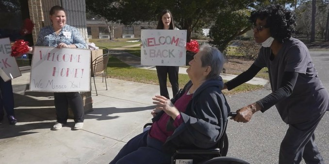
https://www.europesays.com/1833119/ Southport Health and Rehabilitation Center reopens five months after Potential Tropical Cyclone 8 forced it to close #america #Center #Entertainment #event #flooding #health #Homecoming #PotentialTropicalCyclone8 #Ptc8 #rehabilitation #rénovations #reopen #southport #sports #UnitedStates #UnitedStatesOfAmerica #US #USA
Recent searches
Search options
#ptc8
View of Carolina Beach, NC earlier today (via NWS Wilmington, NC)
"Sharon Carlson shared this video with us from Carolina Beach showing the widespread flash flooding that continues across the town. Additional showers and thunderstorms, some heavy, will overspread the area late this afternoon. #ncwx #PTC8"
WaPo: Tropical rainstorm bringing flooding to Carolinas, Mid-Atlantic https://www.washingtonpost.com/weather/2024/09/16/tropical-storm-helene-carolinas-midatlantic/ #ExtremeWeather #flooding #NCwx #SCwx #PTC8

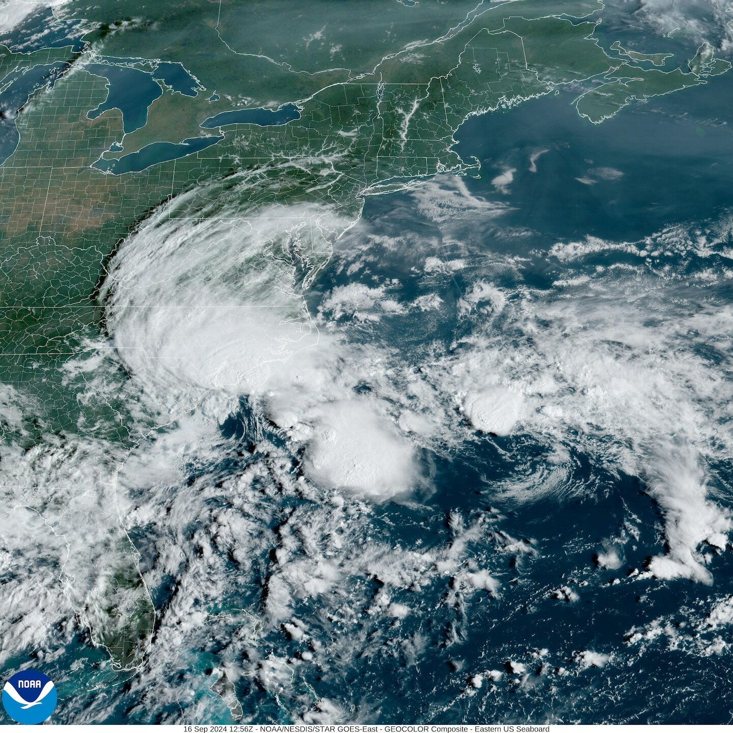
Potential Tropical Cyclone #Eight over the Carolinas, United States earlier today
Flooding is affecting North Carolina as #PTC8 dumps heavy rain inland.
The NHC no longer expects the system to become tropical, but considerable flash and urban flooding is expected to affect parts of the Carolinas overnight.
Just incredible amounts of rain coming out of SE NC, #ncwx #ptc8
Southport, NC: 22.89"
Boiling Spring Lakes, NC: 22.34"
Bald Head Island, NC: 21.68"
Saint James, NC: 21.13"
Oak Island, NC: 20.95"
These are ONLY the top amounts from Accu/Ambient stations for each town. May include more than 48 hours. NWS has 3 stations reporting 18-19".
Sunrise over Potential Tropical Cyclone #Eight near South Carolina, United States
#PTC8 throwing heavy rain near Wilmington, NC. Gusty winds to 50mph or so may accompany. Tornado potential as well, mainly Northeast of storm center Eastern NC. Calmer on South side. Power/tree issues start around 40mph+/-. 735aEDT 16Sept2024
'Potential Tropical Cyclone 8' (formally invest #95L) along Carolina coast. Scattered showers next few days into the region. No surge warning as that typically starts at 3ft+, but still 1-3ft higher water level potential, beach erosion & rip currents. PTC designation started in 2017 for advanced lead time in hazards prior to storm actually forming. #PTC8 15Sept2024
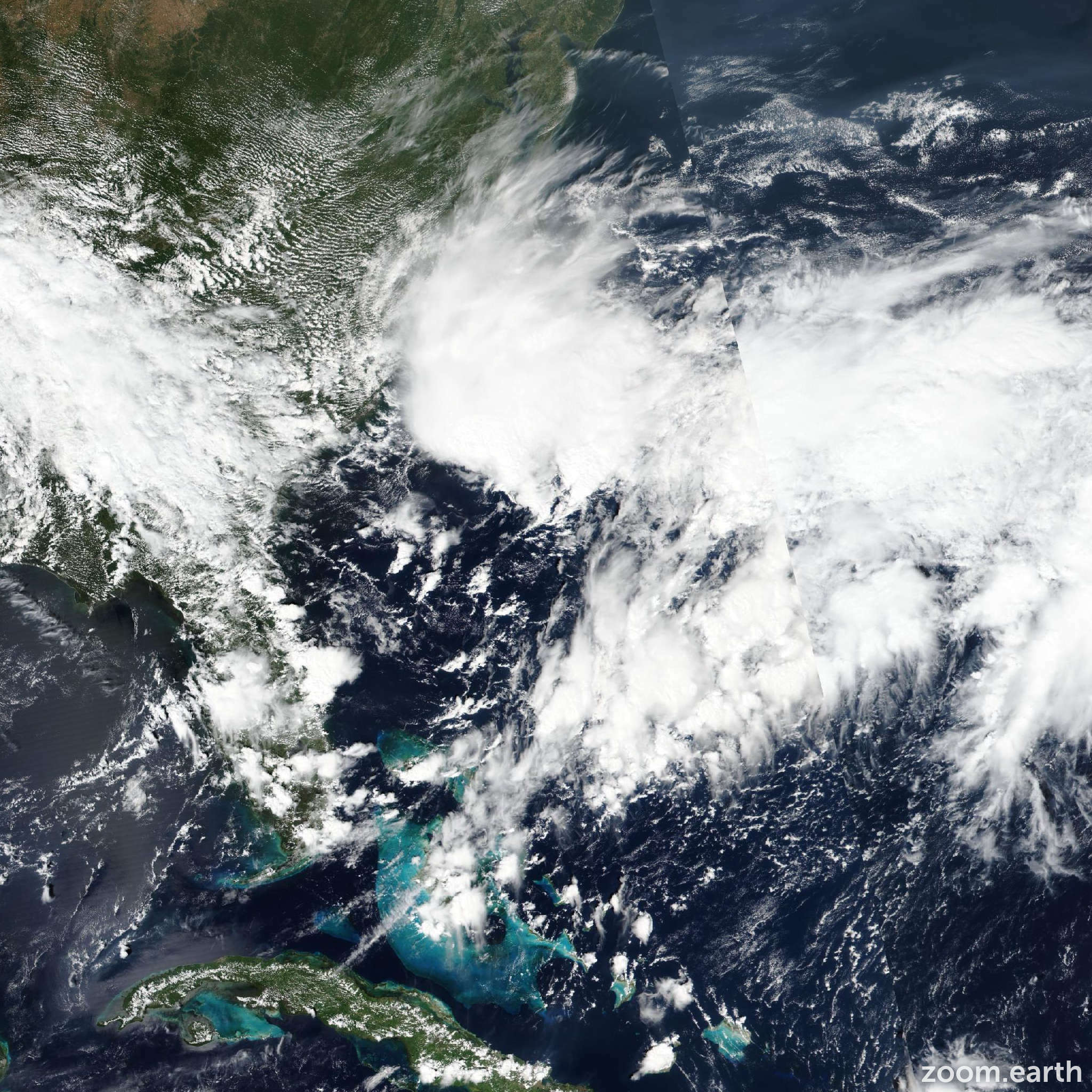
Potential Tropical Cyclone #Eight this evening near South Carolina, United States
BULLETIN
PTC 8 Intermediate Advisory Number # 1A
NWS National Hurricane Center Miami FL
800 PM EDT Sun Sep 15 2024
...POTENTIAL TROPICAL CYCLONE MOVING ERRATICALLY OFF THE COAST OF
THE CAROLINAS...EXPECTED TO BRING HEAVY RAINS AND COASTAL FLOODING...
LOCATION...32.1N 77.8W
ABOUT 140 MI...225 KM ESE OF CHARLESTON SOUTH CAROLINA
MAXIMUM SUSTAINED WINDS...45 MPH...75 KM/H
PRESENT MOVEMENT...NW OR 320 DEGREES AT 7 MPH...11 KM/H
MINIMUM CENTRAL PRESSURE...1006 MB...29.71 INCHES
SUMMARY OF WATCHES AND WARNINGS IN EFFECT:
A Tropical Storm Warning is in effect for...
* Edisto Beach, South Carolina northward to Ocracoke Inlet, North Carolina
Potential Tropical Cyclone #Eight near South Carolina, United States
Potential Tropical Cyclone Eight #PTC8 has been declared near South Carolina, United States.
Latest details here: https://zoom.earth/storms/08l-2024/


